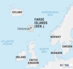
The Faroe Islands are a rugged archipelago of 18 volcanic islands located in the North Atlantic Ocean, halfway between Iceland and Norway, and northwest of Scotland.
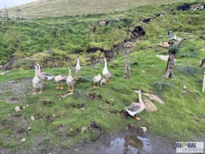
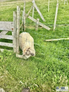
They form a self-governing territory within the Kingdom of Denmark, with their own language, culture, and government.The Faroe Islands offer an unforgettable blend of wild nature, Nordic charm, and solitude — a place where sheep outnumber cars, fog shrouds mountain peaks, and every turn looks like a painting.
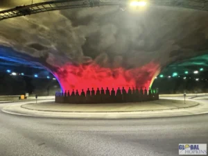
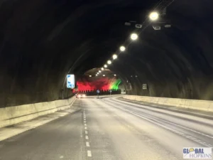
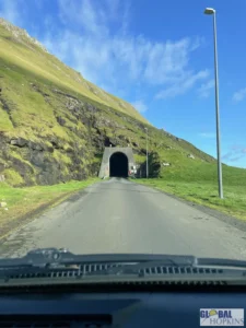
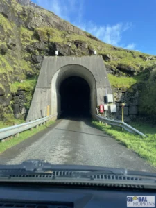
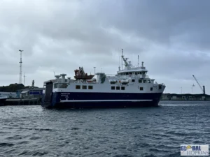
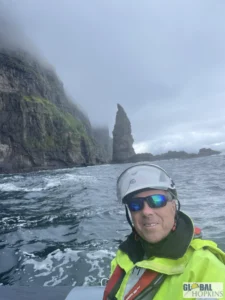
The Faroese government embarked on a bold infrastructure program to link the islands via undersea and mountain tunnels, transforming daily life, commerce, and tourism. There are over 20 tunnels across the Faroes, including both mountain tunnels (boring through ridges) and undersea tunnels (connecting entire islands). The largest tunnel – Eysturoyartunnilin completed in 2020 includes a subsea roundabout – the first of its kind in the world – and an engineering feat. After watching a video of this on YouTube, it sparked my interest in coming to the Faroe Islands.
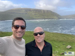
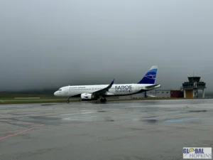
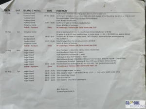
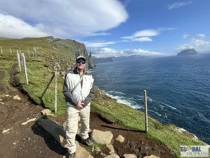
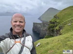
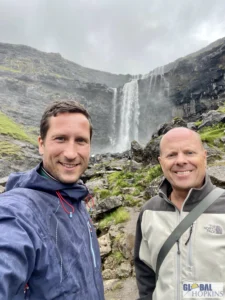
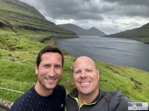
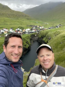
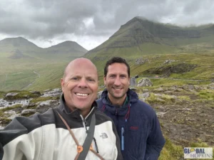
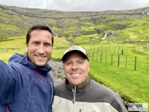
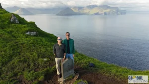
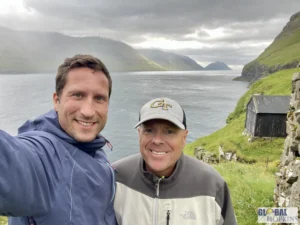
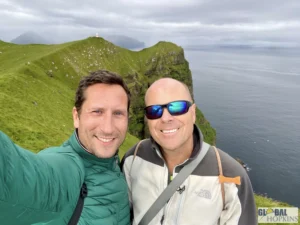
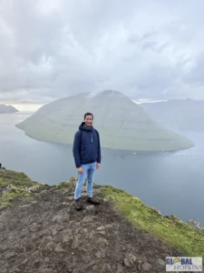
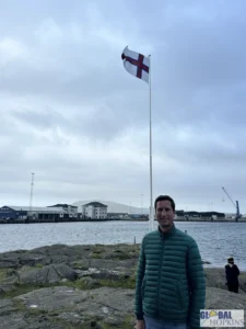
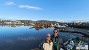
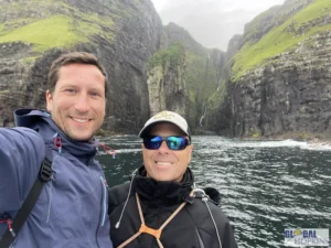
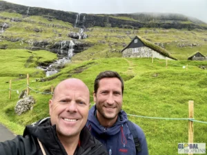
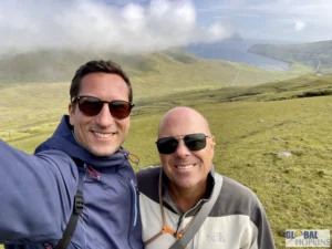
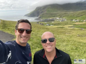
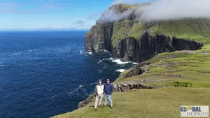
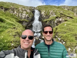
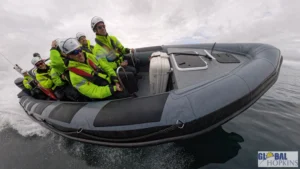
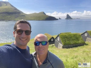
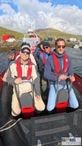
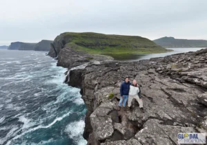
My friend Christian and I rented a car and spent a week driving around and exploring 7 of the major Islands. I highly recommend making a visit to the Faroe Islands.


Vagar Island
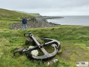
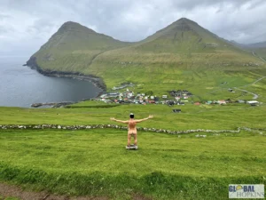
Vágar is often called the “gateway to the Faroe Islands” — not only for the airport but for its dramatic mix of mountains, cliffs, lakes, and waterfalls. It’s home to some of the most photographed natural landmarks in the entire archipelago.
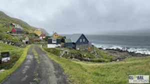
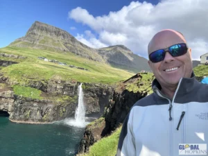
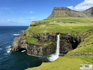
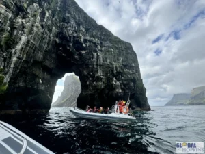
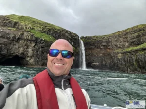
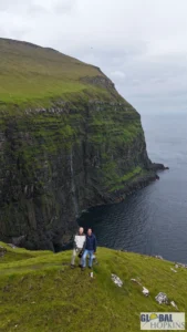
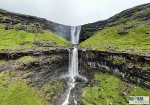
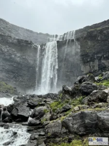
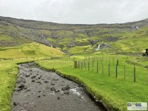
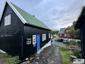
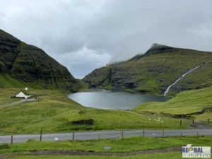
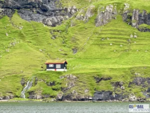
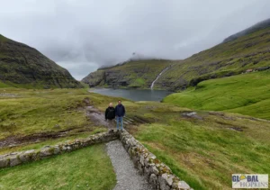
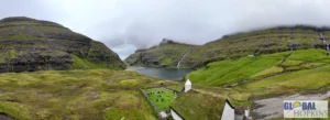
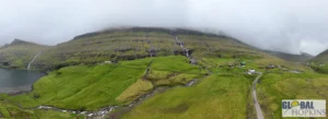
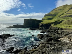
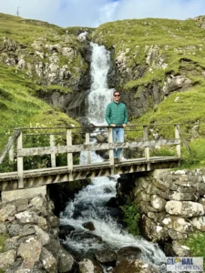
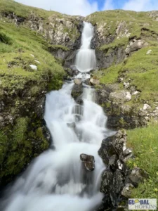
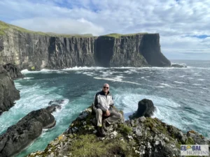
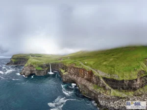
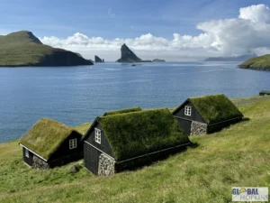
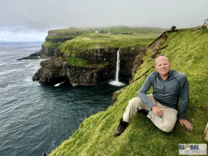
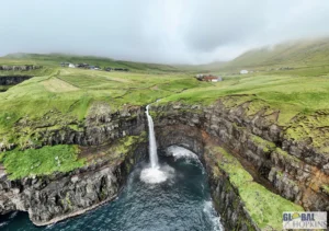
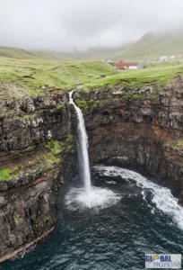
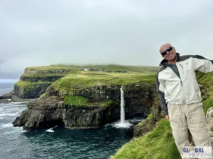
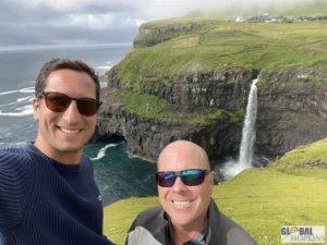
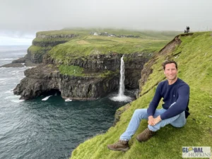
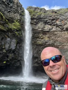
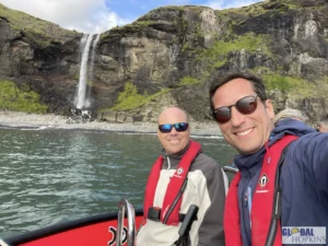
Vágar Island is home to some of the Faroe Islands’ most dramatic and photogenic landscapes, each blending raw natural power with quiet isolation. The most famous of all is Múlafossur Waterfall, a breathtaking cascade that drops straight from a green cliff into the roaring Atlantic Ocean beside the remote village of Gásadalur. Once cut off from the rest of the islands until a tunnel was built in 2004, Gásadalur still feels timeless — a handful of turf-roofed cottages surrounded by sheer cliffs and grazing sheep, with mist drifting in from the sea. The view of the waterfall framed by mountains and ocean has become an icon of the Faroes, perfectly capturing the islands’ rugged beauty.
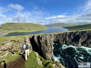
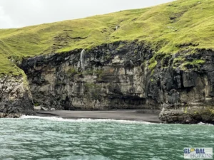
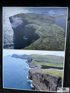
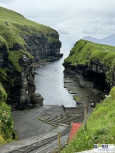
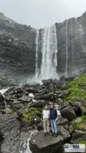
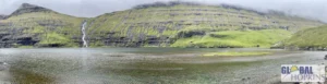
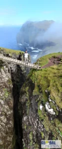
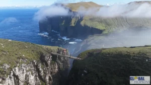
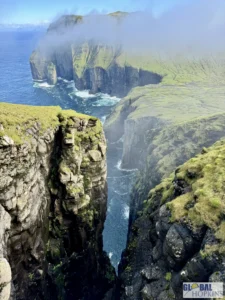
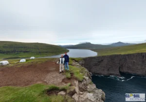
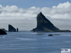
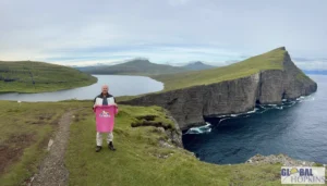
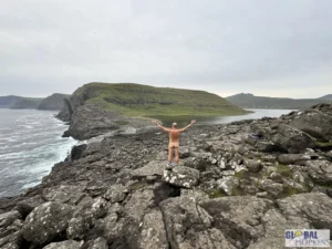
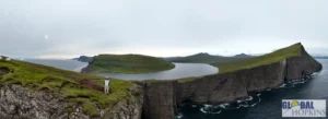
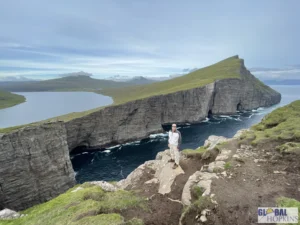
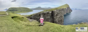
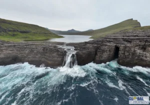
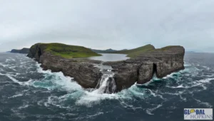
Just east of Gásadalur lies Lake Sørvágsvatn, also called Leitisvatn, the largest lake in the Faroe Islands and one of its most fascinating illusions. From certain vantage points, the lake appears to float high above the ocean, seemingly suspended in midair. A scenic trail leads from the village of Miðvágur to the Trælanípa cliffs, where the illusion reveals itself — a narrow rim of land separates the freshwater lake from the sea below, and at the far edge, the Bøsdalafossur Waterfall spills dramatically into the Atlantic. The hike offers sweeping views over the cliffs and surrounding islands, and on clear days, you can see for miles across the ocean.
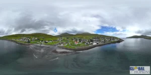
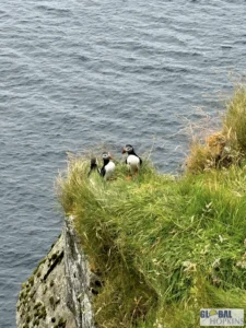
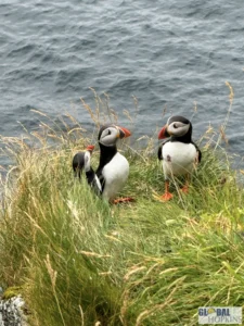
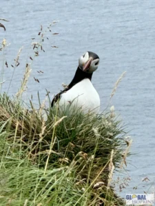
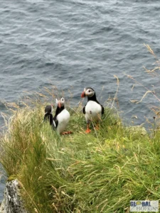
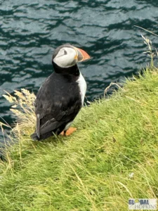
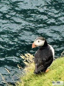
Nearby, the colorful coastal villages of Sandavágur and Sørvágur provide a glimpse into everyday Faroese life. Sandavágur, with its red-roofed church and ancient Viking rune stone, is one of the island’s oldest settlements, while Sørvágur serves as the gateway to Mykines Island, famous for its puffin colonies and sea stacks. A short ferry or helicopter ride from Vágar, Mykines feels like another world — a sanctuary of seabirds, dramatic cliffs, and wind-swept solitude. Together, these sights make Vágar a perfect introduction to the Faroe Islands: a place where waterfalls tumble into the sea, lakes hover above the ocean, and tiny villages cling to the edges of vast, untamed landscapes.
Eysturoy Island
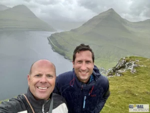
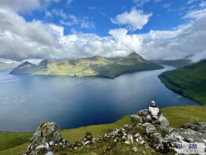
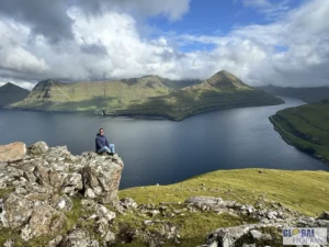
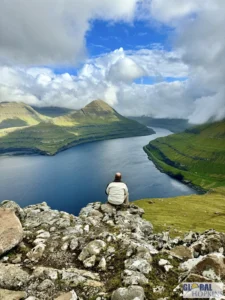
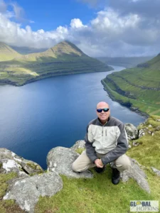
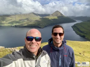
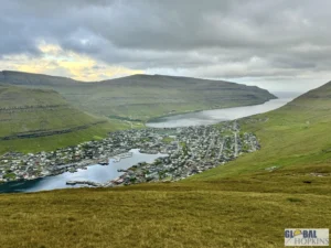
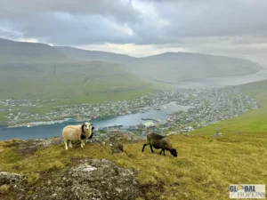
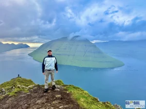
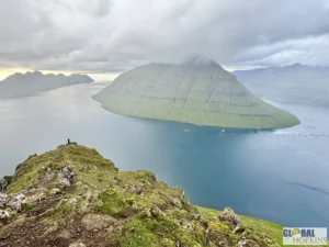
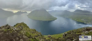
Eysturoy Island — whose name literally means “East Island” — is the second largest island in the Faroe Islands and one of the most scenic, diverse, and accessible parts of the archipelago. It’s linked to the capital, Tórshavn, by both bridge and the spectacular Eysturoyartunnilin undersea tunnel, which features the world’s first underwater roundabout. With its mix of dramatic mountains, charming fishing villages, and legendary fjords, Eysturoy is where you’ll find some of the most breathtaking views and cultural highlights in the Faroes.
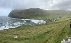
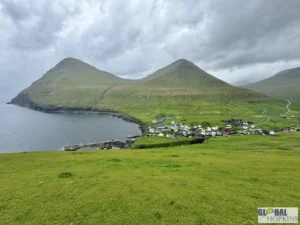
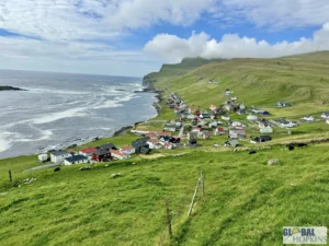
One of Eysturoy’s most famous sights is the village of Gjógv, a postcard-perfect hamlet tucked at the end of a deep natural gorge on the island’s northern tip. The village’s name means “gorge” in Faroese, and this distinctive sea inlet was once its lifeline — a natural harbor used for launching fishing boats. Today, Gjógv is a favorite destination for visitors, offering colorful turf-roofed houses set against steep green mountains and views across the sea to Kalsoy Island. The area has several scenic hiking trails, and in calm weather, the gorge itself makes a beautiful photo stop. Gjógv perfectly captures the peaceful, pastoral charm that defines rural life in the Faroes.
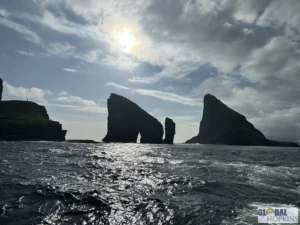
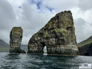
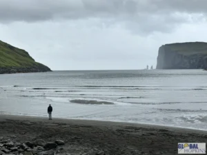
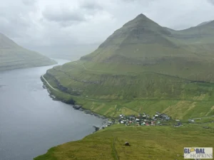
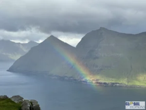
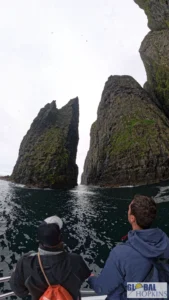
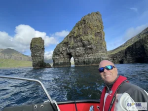
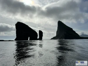
Further south, near the villages of Eiði and Funningur, rises Slættaratindur, the highest mountain in the Faroe Islands at 880 meters (2,887 feet). The hike to its summit is relatively short but steep, and on clear days, the reward is extraordinary — panoramic views across nearly all 18 islands, with the Atlantic stretching endlessly beyond. Nearby, just off the coast near Eiði, stand the Risin og Kellingin sea stacks, two towering rock formations said by legend to be a giant and his wife turned to stone as they tried to drag the Faroe Islands back to Iceland. These dramatic pillars, pounded by waves and shrouded in mist, are among the most iconic natural landmarks in the country.
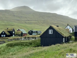
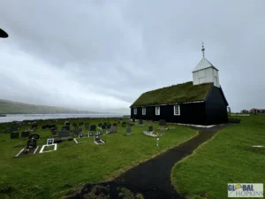
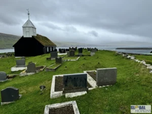
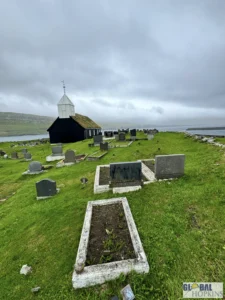
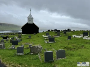
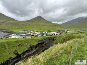
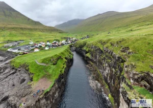
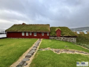
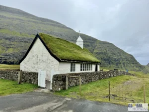
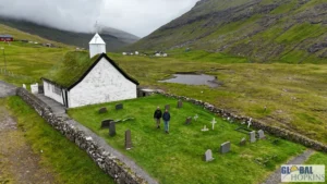
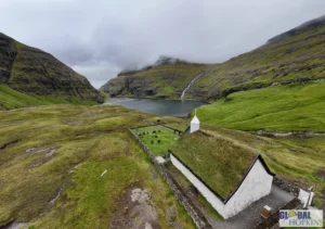
The village of Funningur, nestled deep in one of Eysturoy’s fjords, is believed to be the site of the very first Norse settlement in the Faroe Islands, dating back to around 825 CE. Its wooden church, built in 1847, is one of the most picturesque in the islands, perched beside the water and surrounded by turf-covered cottages. Meanwhile, Eiði, just a short drive away, offers striking coastal views and easy access to both Slættaratindur and the northern sea stacks.


Kalsoy Island
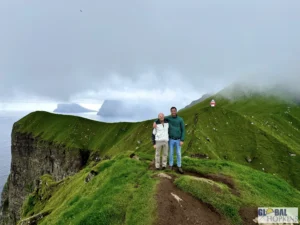
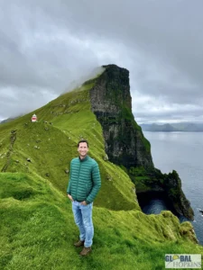
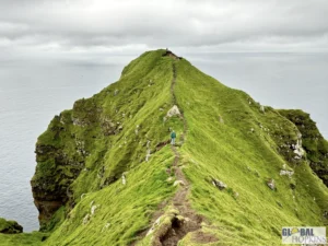
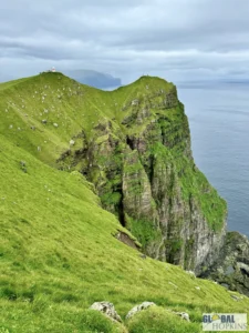
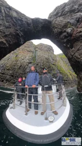
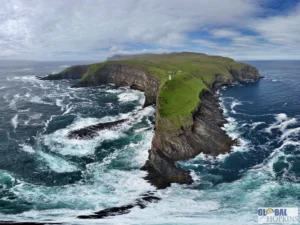
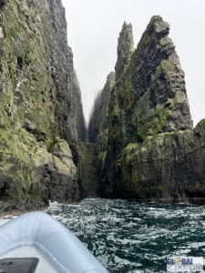
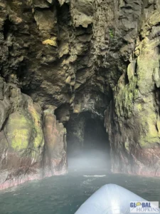
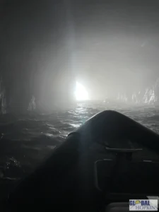
Kalsoy Island is one of the most dramatic and mysterious of all the Faroe Islands — a long, slender stretch of green cliffs and dark tunnels often nicknamed “the flute island” because of its narrow shape and multiple passages drilled straight through its mountains. It’s remote, wild, and hauntingly beautiful — the kind of place where folklore, mist, and landscape all seem to merge.
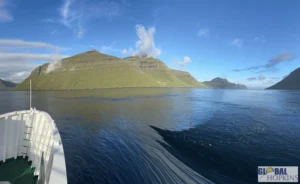
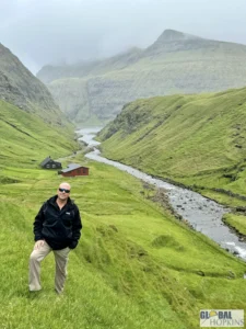
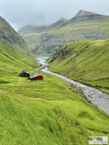
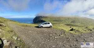
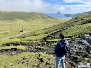
The island is reached by a short ferry ride from the village of Klaksvík on Borðoy, and the journey itself sets the mood: the sea crossing, the looming cliffs, and the sense of isolation as you approach the small port of Syðradalur, the gateway to Kalsoy. A single, narrow road runs the island’s entire length, connecting a string of tiny villages — Húsar, Mikladalur, Trøllanes, and others — through a series of single-lane tunnels carved by hand decades ago. Driving here is an adventure in itself, with headlights piercing the darkness and occasional passing bays where cars squeeze past each other in the gloom.
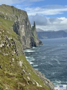
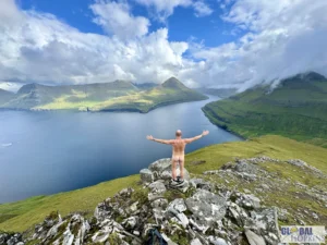
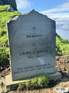
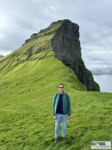
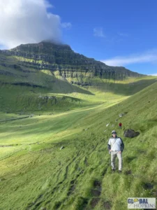
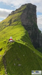
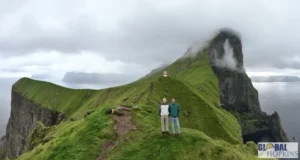
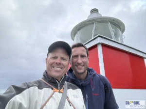
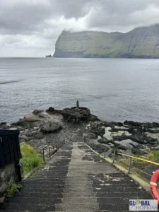
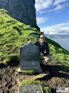
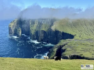
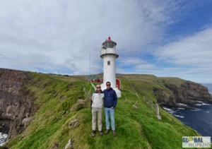
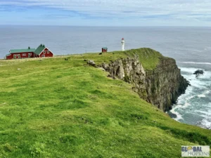
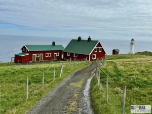
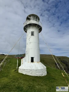
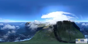
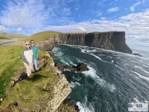
The highlight of Kalsoy, and one of the most famous spots in the Faroe Islands, is the Kallur Lighthouse near the northern tip of the island, above the village of Trøllanes. Reaching it requires a moderate hike of about 45–60 minutes each way across open grassland, but the reward is one of the most breathtaking viewpoints in all of Europe. The lighthouse sits on a narrow ridge with the Atlantic Ocean crashing on both sides, and from its summit, you can see the neighboring islands of Kunoy and Eysturoy rising out of the mist. On clear days, the panorama is spectacular; on foggy days, the cliffs seem to fade into infinity. It’s also the site of the James Bond film “No Time To Die” (2021) climax — a fact that has made the lighthouse hike even more famous among visitors.
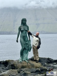
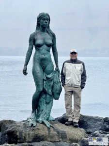
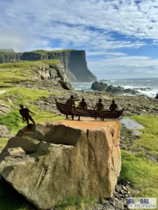
Just south of Trøllanes lies the village of Mikladalur, famous for its legend of the Seal Woman (Kópakonan). According to Faroese folklore, seals were once humans who shed their skins to dance on land at night. A local man, entranced by a beautiful seal woman, stole her sealskin so she couldn’t return to the sea and forced her to become his wife. Years later, she found her hidden skin and escaped, but she cursed the men of the village before disappearing into the waves. Today, a haunting bronze statue of the Seal Woman stands on the rocks by the shore, gazing eternally toward the sea — one of the most moving and photographed sculptures in the Faroes.

Bordoy Island
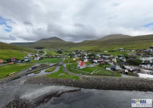
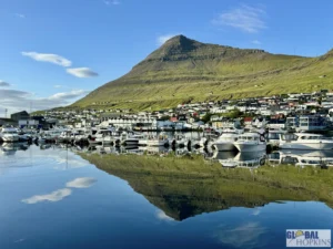
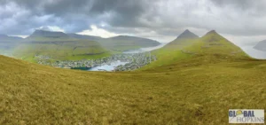
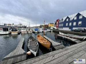
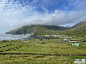
Borðoy Island is one of the most important and picturesque islands in the Faroe Islands, serving as the cultural and economic hub of the northern region. It’s the largest of the Northern Isles and home to Klaksvík, the Faroes’ second-largest town — a lively harbor community surrounded by mountains and fjords. While Borðoy offers modern conveniences and easy access to nearby islands, it also retains the wild beauty and deep sense of isolation that define the archipelago.
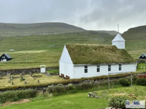
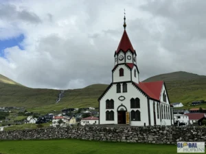
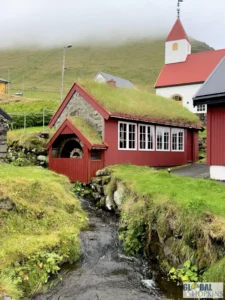
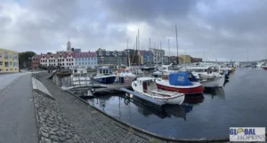
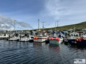
The island’s centerpiece is Klaksvík, a town beautifully set between two mountain ridges, with a calm fjord reflecting the fishing boats that anchor its life. Klaksvík has evolved from a small fishing settlement into one of the Faroes’ most dynamic towns, yet it maintains an intimate, local charm. The highlight here is Christianskirkjan, or the Christian’s Church, a striking piece of modern Faroese architecture completed in 1963. Built primarily from native basalt stone, the church features a huge wooden boat hanging from its ceiling, symbolizing faith and the sea — two forces that have always shaped Faroese life. Its design, inspired by old Norse and early Christian architecture, gives it a quiet power, especially with the surrounding mountains as a backdrop.
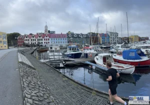
Torshavn – Capital of Faroe Islands
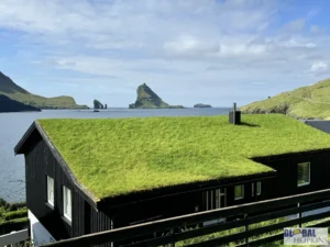
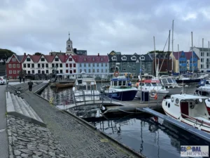
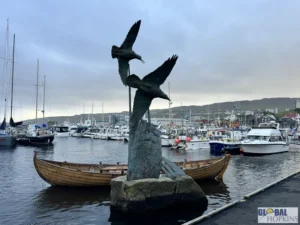
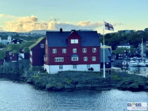
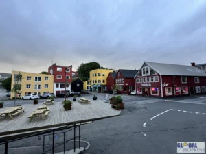
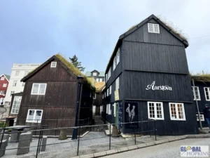
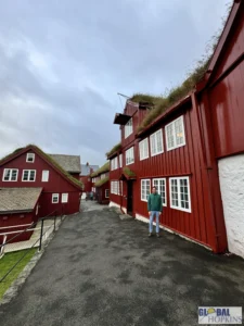
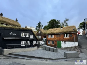
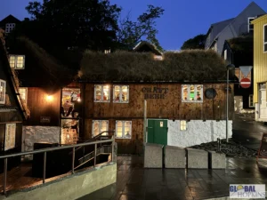
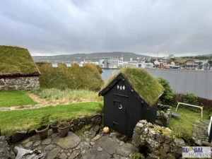
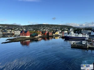
Tórshavn, the capital of the Faroe Islands, is one of the smallest and most charming capitals in the world — a place where modern Nordic life meets centuries of maritime history and cozy village charm. Nestled between misty mountains and the North Atlantic, this compact harbor city on Streymoy Island is not just the administrative and cultural heart of the Faroes but also its emotional one. With turf-roofed houses, colorful harborside cafés, and a lively yet relaxed rhythm, Tórshavn perfectly embodies the Faroese spirit — proud, creative, and deeply connected to nature.
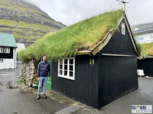
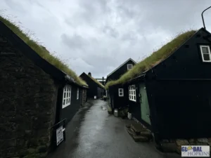
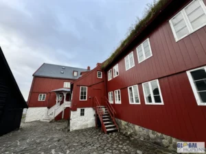
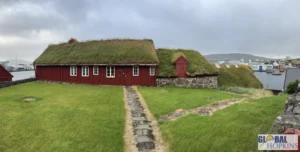
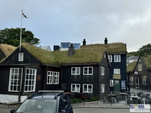
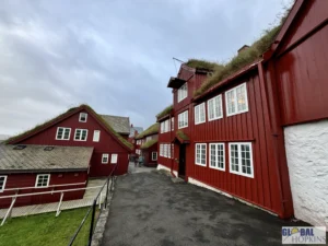
The most enchanting part of the city is Tinganes, the historic old town and one of the oldest parliamentary meeting places in the world. Here, narrow cobbled lanes wind between clusters of 16th- and 17th-century wooden houses, their black-tarred walls and grassy roofs looking almost unchanged for centuries. This is where the Faroese parliament, or Løgting, first gathered over a thousand years ago, and even today, the government offices remain housed in some of these turf-roofed buildings. Walking through Tinganes feels like stepping back in time — the air smells of salt and timber, and the harbor below still hums with the life of fishing boats coming and going.


Streymoy Island
Streymoy Island is the largest and most populous island in the Faroe Islands, serving as both the geographical and cultural heart of the archipelago. It’s home to the capital city, Tórshavn, yet just minutes outside the capital, you find sweeping fjords, tumbling waterfalls, turf-roofed villages, and some of the most dramatic coastal scenery in the North Atlantic. Streymoy blends modern Faroese life with wild, unspoiled landscapes — making it the perfect base for exploring the islands.
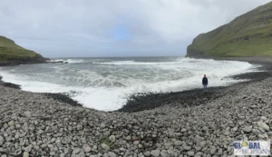
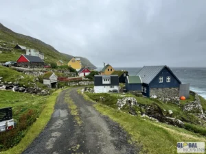
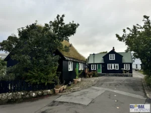
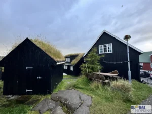
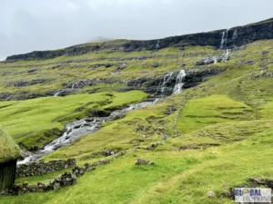
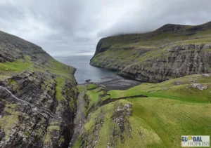
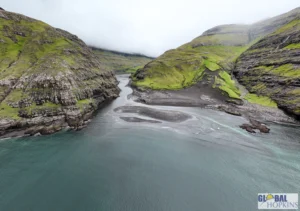
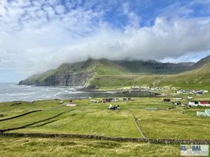
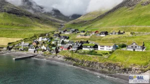
In the north of Streymoy, the landscape turns wilder and more dramatic. The village of Saksun is a breathtaking highlight — a cluster of turf-roofed cottages nestled around a tranquil tidal lagoon framed by towering cliffs. Once a fjord connected to the sea, the lagoon is now partially closed off by sand, creating an otherworldly setting that shifts with the tide. There’s also a small museum inside the historic Dúvugarðar Farmhouse, showing what life was like in earlier centuries. A scenic trail leads from Saksun toward Tjørnuvík, another stunning village set at the mouth of a bay surrounded by mountains.
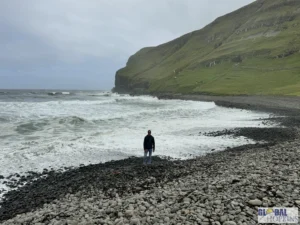
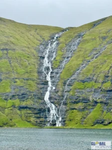
Tjørnuvík is the northernmost village on Streymoy, known for its dramatic setting and black-sand beach. It’s also one of the best spots in the Faroes to view the towering sea stacks Risin og Kellingin — the “Giant and the Witch,” legendary rock formations that rise from the sea just off neighboring Eysturoy. Locals tell that the two figures were trying to tow the Faroes to Iceland before sunrise turned them to stone. The village itself is peaceful, with brightly painted houses, waterfalls tumbling down nearby slopes, and a beautiful view of the Atlantic.
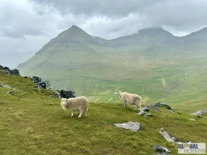
The drive between Saksun and Tjørnuvík is one of the most scenic routes in the islands, winding through green valleys and high mountain passes. Along the way, you’ll see sheep grazing freely and glimpses of the sea in every direction — a reminder of how closely the Faroese live with nature.


Suduroy Island
Suðuroy Island is the southernmost of the Faroe Islands and is often described as the archipelago’s most rugged and remote gem. It’s less visited than the northern islands, giving it a sense of isolation and wild beauty that makes it feel like a world apart. Despite its small population, Suðuroy is rich in dramatic landscapes, quaint villages, and cultural traditions that reflect the resilience and maritime heritage of the Faroese people.
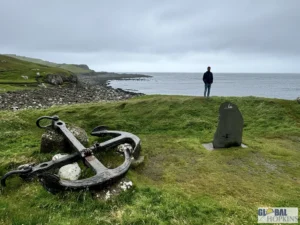
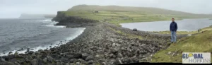
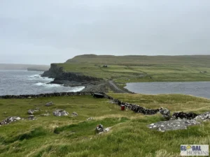
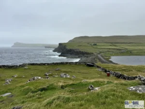
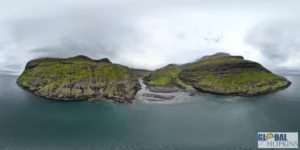
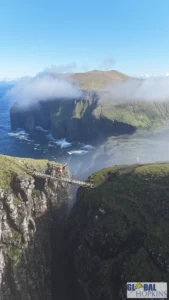
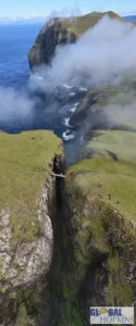
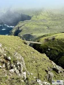
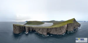
Rituskor Bridge connects the mainland of Suðuroy to a small, grassy outcrop where sheep graze freely year-round. This outcrop is triangular in shape, with each side measuring around 300 meters (984 feet). The area is accessible via a scenic hiking trail that begins in the village of Sandvík, the northernmost settlement on Suðuroy. The hike is relatively easy but offers continuous vistas of the sensational landscape, making it a rewarding experience for nature enthusiasts
Hestur Island
Hestur Island is a small, tranquil island in the Faroe archipelago, located just a few kilometers west of Streymoy, the main island where Tórshavn sits. Its name literally means “Horse” in Faroese, and while it’s one of the smaller inhabited islands, it’s renowned for its peaceful rural landscapes, steep cliffs, and dramatic coastal scenery. Hestur offers a rare glimpse of traditional Faroese life, largely untouched by tourism, making it ideal for visitors seeking solitude and unspoiled nature.
One of Hestur’s most striking highlights is its rugged coastline and bird cliffs. The island’s cliffs rise steeply from the ocean, providing nesting sites for puffins, guillemots, and other seabirds in summer. Walking along the cliff paths, visitors can take in panoramic views of the surrounding islands, including Koltur to the southwest and Streymoy to the east. The hiking trails are relatively short but steep, rewarding trekkers with vistas of rolling green hills, jagged cliffs, and the endless Atlantic beyond.
Vagar Island Revisited!
The top sight on Vágar Island — and arguably in the entire Faroe Islands — is the Múlafossur Waterfall near the tiny village of Gásadalur. This breathtaking natural wonder captures the essence of the Faroes’ wild, untouched beauty. From the moment you round the bend in the road and glimpse the scene, it feels almost unreal: a slender ribbon of water cascading directly off a grassy cliff into the churning Atlantic Ocean below, framed by towering sea cliffs and the distant silhouettes of neighboring islands.
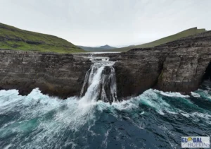
Just as impressive – Bøsdalafossur Waterfall originates from Lake Sørvágsvatn, which sits on a cliff above the Atlantic Ocean. Water from the lake flows toward the edge of the cliff and then cascades roughly 30 meters (98 feet) into the ocean below. From certain viewpoints, the lake seems almost level with the cliff edge, creating a surreal illusion that it’s floating high above the sea. This optical effect is enhanced by the slope of the surrounding terrain and the way the cliffs are positioned, making the waterfall look even more dramatic in photographs.
Sandoy Island
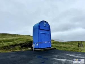
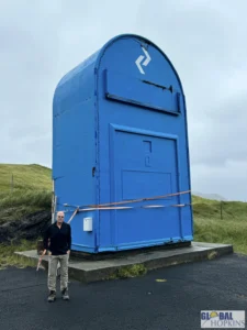
Sandoy Island is one of the central islands in the Faroes, known for its flat, gently rolling landscape, wide sandy beaches, and a calmer, pastoral atmosphere that contrasts with the steeper, cliff-dominated islands nearby. Its name, meaning “Sand Island,” reflects its distinctive geography: unlike the jagged mountains of Vágar or Streymoy, Sandoy’s terrain is smoother, with open fields, fertile farmland, and small lakes, giving it a serene, almost idyllic character. And it is home to the largest mailbox in the world.